filter-iconFilter
close-icon
Media type
License type
Orientation
Style
Exclude

Central America Map Stock Vectors, Clipart and Illustrations

Central america design vector illustration eps10 graphic Stock Photo
Central america design vector illustration eps10 graphic
VectorsSimilar Images
Central america map separate individual states with state names color map isolated on white background vector
Central america map separate individual states with state names color map isolated on white background vector123RF Premium
VectorsSimilar Images
Central america map grey silhouette illustration
VectorsSimilar Images
Map of central america
VectorsSimilar Images
Black map of central america with names of regions design blackboard vector
Black map of central america with names of regions design blackboard vector123RF Premium
VectorsSimilar Images
Map of central america in blue colour
Map of central america in blue colour123RF Premium
VectorsSimilar Images
Map of central america region with green highlighted central american states country name labels simple flat vector illustration
Map of central america region with green highlighted central american states country name labels simple flat vector illustration123RF Premium
VectorsSimilar Images
Central america map separates states with names blue white card paper 3d vector Stock Photo
Central america map separates states with names blue white card paper 3d vector123RF Premium
VectorsSimilar Images
Modern map central america with country borders
VectorsSimilar Images
Central america map administrative division separates regions and names individual card paper 3d natural vector Stock Photo
Central america map administrative division separates regions and names individual card paper 3d natural vector123RF Premium
VectorsSimilar Images
Central america map separate states whit names blue background vector
Central america map separate states whit names blue background vector123RF Premium
VectorsSimilar Images
Central america map with country borders grey illustration Stock Photo
Central america map with country borders grey illustration
VectorsSimilar Images
Location of el salvador on central america
VectorsSimilar Images
Modern map central america Stock Photo
Modern map central america
VectorsSimilar Images
Political color map of south asia with borders of the states
Political color map of south asia with borders of the states123RF Premium
VectorsSimilar Images
Political map of mexico and central amercia simlified schematic flat vector map in four color scheme Vector Illustration
Political map of mexico and central amercia simlified schematic flat vector map in four color scheme123RF Premium
VectorsSimilar Images
Political map of central america vector illustration design
VectorsSimilar Images
Political map of central america and mexico in four shades of green simple flat vector illustration
Political map of central america and mexico in four shades of green simple flat vector illustration123RF Premium
VectorsSimilar Images
Map of central america and the carrbean with shadow
VectorsSimilar Images
Map of central america
VectorsSimilar Images
Location of nicaragua on central america Stock Photo
Location of nicaragua on central america
VectorsSimilar Images
Honduras map with pin of country capital two types of honduras map with neighboring countries vector template
Honduras map with pin of country capital two types of honduras map with neighboring countries vector template123RF Premium
VectorsSimilar Images
El salvador map illustration
VectorsSimilar Images
Map of central america with shadow
VectorsSimilar Images
Central america map Vector Illustration
Central america map123RF Premium
VectorsSimilar Images
Central america and carribean states political map in four shades of grey with black country names labels simple flat vector illustration
Central america and carribean states political map in four shades of grey with black country names labels simple flat vector illustration123RF Premium
VectorsSimilar Images
Infographics central america map flat design colors with names of individual states blue background with orange points vector
Infographics central america map flat design colors with names of individual states blue background with orange points vector123RF Premium
VectorsSimilar Images
Central america map highly detailed vector illustration Stock Photo
Central america map highly detailed vector illustration
VectorsSimilar Images
Green central america map with country borders Stock Photo
Green central america map with country borders
VectorsSimilar Images
Political map of central american and caribbean
Political map of central american and caribbean123RF Premium
VectorsSimilar Images
Location of panama on central america
VectorsSimilar Images
Scribble sketch honduras
VectorsSimilar Images
Central america vector maps of territories
VectorsSimilar Images
Central america high detailed political map central american and caribbean region with country ocean and sea names labeling
Central america high detailed political map central american and caribbean region with country ocean and sea names labeling123RF Premium
VectorsSimilar Images
El salvador vector map with country name black on white background Stock Photo
El salvador vector map with country name black on white background123RF Premium
VectorsSimilar Images
Abstract high detailed blue map of central america isolated on white background
Abstract high detailed blue map of central america isolated on white background123RF Premium
VectorsSimilar Images
Central america and carribean states political map black outline borders with black country names labels on blue background simple flat vector illustration Vector Illustration
Central america and carribean states political map black outline borders with black country names labels on blue background simple flat vector illustration123RF Premium
VectorsSimilar Images
Central america detailed political map with lables Stock Photo
Central america detailed political map with lables123RF Premium
VectorsSimilar Images
America central and caribbean map
America central and caribbean map123RF Premium
VectorsSimilar Images
Mexico map new political detailed map separate individual states with state names isolated on white background Stock Photo
Mexico map new political detailed map separate individual states with state names isolated on white background
VectorsSimilar Images
Central america map individual states with names white blue card paper 3d vector
Central america map individual states with names white blue card paper 3d vector123RF Premium
VectorsSimilar Images
Central america and carribean states political map yellow land with black country names labels on blue sea background simple flat vector illustration Vector Illustration
Central america and carribean states political map yellow land with black country names labels on blue sea background simple flat vector illustration123RF Premium
VectorsSimilar Images
Vector street map of the states of central america Vector Illustration
Vector street map of the states of central america123RF Premium
VectorsSimilar Images
Mexico orange marked in political map of central america simple flat vector illustration Vector Illustration
Mexico orange marked in political map of central america simple flat vector illustration123RF Premium
VectorsSimilar Images
Political map of mexico and central amercia simlified schematic flat vector map in four shades of turquoise blue
Political map of mexico and central amercia simlified schematic flat vector map in four shades of turquoise blue123RF Premium
VectorsSimilar Images
Central america dark silhouette map isolated on white background Stock Photo
Central america dark silhouette map isolated on white background
VectorsSimilar Images
Central america map and navigation icons illustration
VectorsSimilar Images
Map of costa rica and nearby countries costa rica is highlighted in white
VectorsSimilar Images
Central america map with capitals of states design glass card 3d vector
Central america map with capitals of states design glass card 3d vector123RF Premium
VectorsSimilar Images
Mexico map outline vector with borders of provinces or states
VectorsSimilar Images
Central america map infographics flat design colors snow white with names of individual states and city vector
Central america map infographics flat design colors snow white with names of individual states and city vector123RF Premium
VectorsSimilar Images
A simplified map of mexico in the north america
VectorsSimilar Images
Black central america map with country borders
VectorsSimilar Images
Isometric political map of americas colorful land with country name labels on white background 3d vector illustration
Isometric political map of americas colorful land with country name labels on white background 3d vector illustration123RF Premium
VectorsSimilar Images
Political map of central amercia simlified schematic flat vector map in shades of turquoise blue
Political map of central amercia simlified schematic flat vector map in shades of turquoise blue123RF Premium
VectorsSimilar Images
Political map of central america and mexico in four shades of turquoise blue simple flat vector illustration
Political map of central america and mexico in four shades of turquoise blue simple flat vector illustration123RF Premium
VectorsSimilar Images
Political map of central amercia simlified schematic flat vector map in four color scheme
Political map of central amercia simlified schematic flat vector map in four color scheme123RF Premium
VectorsSimilar Images
Central america and caribbean states political map simple flat vector illustration Vector Illustration
Central america and caribbean states political map simple flat vector illustration123RF Premium
VectorsSimilar Images
Costa rica map vector solid contour and state regions illustration
Costa rica map vector solid contour and state regions illustration123RF Premium
VectorsSimilar Images
A large and detailed map of costa rica with all provinces cities and main cantones
A large and detailed map of costa rica with all provinces cities and main cantones123RF Premium
VectorsSimilar Images
Political map of central amercia simlified schematic flat vector map in shades of pink
Political map of central amercia simlified schematic flat vector map in shades of pink123RF Premium
VectorsSimilar Images
Central america map individual states with names infographics and icons vector Stock Photo
Central america map individual states with names infographics and icons vector123RF Premium
VectorsSimilar Images
Central america detailed political map with lables
Central america detailed political map with lables123RF Premium
VectorsSimilar Images
Journey to honduras illustration with a map of honduras background with airplane cell phone passport compass and tickets vector mockup
Journey to honduras illustration with a map of honduras background with airplane cell phone passport compass and tickets vector mockup123RF Premium
VectorsSimilar Images
Aztec empire map of the triple alliance and maximal extent in 1519 before the spanish arrival red mesoamerica pre columbian cultural historical area of central america
Aztec empire map of the triple alliance and maximal extent in 1519 before the spanish arrival red mesoamerica pre columbian cultural historical area of central america123RF Premium
VectorsSimilar Images
Editable central america map with all countries
VectorsSimilar Images
Costa rica political map Stock Photo
Costa rica political map
VectorsSimilar Images
Editable central america map with all countries
VectorsSimilar Images
Central america map high detailed political map central american and caribbean region with country ocean and sea names labeling
Central america map high detailed political map central american and caribbean region with country ocean and sea names labeling123RF Premium
VectorsSimilar Images
Caribbean islands central america map new political detailed map separate individual states with state names isolated on white background 3d Stock Photo
Caribbean islands central america map new political detailed map separate individual states with state names isolated on white background 3d
VectorsSimilar Images
Contour central america map with country borders
VectorsSimilar Images
Location of guatemala on the world map with enlarged map of guatemala with flag geographical vector template for your design Stock Photo
Location of guatemala on the world map with enlarged map of guatemala with flag geographical vector template for your design123RF Premium
VectorsSimilar Images
North and south america political map on white and map icons vector illustration
North and south america political map on white and map icons vector illustration123RF Premium
VectorsSimilar Images
Caribbean region map of countries in caribbean sea in central america vector illustration
Caribbean region map of countries in caribbean sea in central america vector illustration123RF Premium
VectorsSimilar Images
North and south america map in colors of blue no text vector illustration
North and south america map in colors of blue no text vector illustration123RF Premium
VectorsSimilar Images
Location of nicaragua on the world map with enlarged map of nicaragua with flag geographical vector template for your design Stock Photo
Location of nicaragua on the world map with enlarged map of nicaragua with flag geographical vector template for your design123RF Premium
VectorsSimilar Images
Central america and caribbean islands map classic color individual states and city whit names vector
Central america and caribbean islands map classic color individual states and city whit names vector123RF Premium
VectorsSimilar Images
North south and central america continent world map made of colorful speech bubbles concept illustration background vector
VectorsSimilar Images
Central america with highlighted belize map vector illustration
VectorsSimilar Images
Variety color polygon map on white background of map of central america symbol for your web site design map logo app ui travel vector eps10 concept illustration Stock Photo
Variety color polygon map on white background of map of central america symbol for your web site design map logo app ui travel vector eps10 concept illustration
VectorsSimilar Images
Central america map high detailed political map central american and caribbean region with country ocean and sea names labeling
Central america map high detailed political map central american and caribbean region with country ocean and sea names labeling123RF Premium
VectorsSimilar Images
Central america map green hue colored on dark background high detailed political map central american and caribbean region with country capital ocean and sea names labeling
Central america map green hue colored on dark background high detailed political map central american and caribbean region with country capital ocean and sea names labeling123RF Premium
VectorsSimilar Images
Maya high culture area map classic and post classic maya civilization in mesoamerica political map with capitals national borders most important ancient cities rivers and lakes Stock Photo
Maya high culture area map classic and post classic maya civilization in mesoamerica political map with capitals national borders most important ancient cities rivers and lakes
VectorsSimilar Images
Dominican republic map vector illustration scribble sketch dominican republic
VectorsSimilar Images
Color political map of north and south america and country flag icons Stock Photo
Color political map of north and south america and country flag icons
VectorsSimilar Images
Isometric paper map of belize with triangular flag of belize in isometric style map on topographic background vector illustration
Isometric paper map of belize with triangular flag of belize in isometric style map on topographic background vector illustration123RF Premium
VectorsSimilar Images
Costa rica map vector illustration scribble sketch costa rica
VectorsSimilar Images
Mexico map detailed vector illustration
VectorsSimilar Images
Central america map detailed illustration
VectorsSimilar Images
Middle america political map with borders and english labeling countries of southern north america the nations of central america and the caribbean gray illustration on white background vector
VectorsSimilar Images
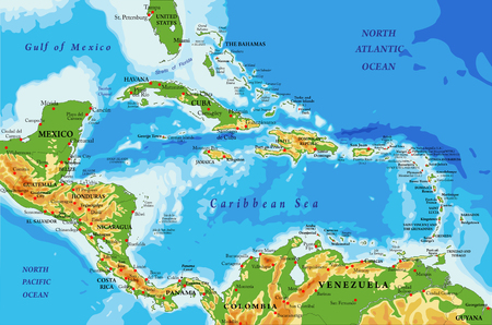
Central america and caribbean islands physical map
Central america and caribbean islands physical map123RF Premium
VectorsSimilar Images
Modern map central america with country borders colored
VectorsSimilar Images
Central america simple outline blank map
Central america simple outline blank map123RF Premium
VectorsSimilar Images
Nicaragua map with pin of country capital two types of nicaragua map with neighboring countries vector template
Nicaragua map with pin of country capital two types of nicaragua map with neighboring countries vector template123RF Premium
VectorsSimilar Images
Yucatan peninsula political map large peninsula in southeastern mexico and adjectants portions of belize and guatemala separating the gulf of mexico and caribbean sea with el salvador and honduras Stock Photo
Yucatan peninsula political map large peninsula in southeastern mexico and adjectants portions of belize and guatemala separating the gulf of mexico and caribbean sea with el salvador and honduras123RF Premium
VectorsSimilar Images
Mexico map new political detailed map separate individual states with state names glass card 3d state names isolated on white background 3d vector Stock Photo
Mexico map new political detailed map separate individual states with state names glass card 3d state names isolated on white background 3d vector
VectorsSimilar Images
Countries of central america map with administrative divisions of belize guatemala honduras el salvador nicaragua costa rica and panama colorful map with labels Vector Illustration
Countries of central america map with administrative divisions of belize guatemala honduras el salvador nicaragua costa rica and panama colorful map with labels123RF Premium
VectorsSimilar Images
Central america region map of countries in central part of america vector illustration Vector Illustration
Central america region map of countries in central part of america vector illustration123RF Premium
VectorsSimilar Images
Map of central america and caribbean simlified schematic vector map in shades of pink
Map of central america and caribbean simlified schematic vector map in shades of pink123RF Premium
VectorsSimilar Images
Vector map of province limon with flag and location on costa rican map Vector Illustration
Vector map of province limon with flag and location on costa rican map123RF Premium
VectorsSimilar Images