filter-iconFilter
close-icon
Media type
License type
Orientation
Style
Exclude

Europe Sea Stock Vectors, Clipart and Illustrations

Vector mosaic and solid map of mediterranean sea map of mediterranean sea vector mosaic for clean water ads map of mediterranean sea is composed with blue clear water dews
Vector mosaic and solid map of mediterranean sea map of mediterranean sea vector mosaic for clean water ads map of mediterranean sea is composed with blue clear water dews123RF Premium
VectorsSimilar Images
Northern europe political map british isles fennoscandia jutland peninsula baltic plain lying to the east and the islands offshore from mainland northern europe and the main Stock Photo
Northern europe political map british isles fennoscandia jutland peninsula baltic plain lying to the east and the islands offshore from mainland northern europe and the main123RF Premium
VectorsSimilar Images
South europe region map of countries in southern europe around mediterranean sea vector illustration
South europe region map of countries in southern europe around mediterranean sea vector illustration123RF Premium
VectorsSimilar Images
Europe physical map
Europe physical map123RF Premium
VectorsSimilar Images
Pixelated mediterranean sea map abstract territorial plan dots have rhombic shape and dark blue color vector pattern of mediterranean sea map designed of rhombic element mosaic
VectorsSimilar Images
Island of crete in greece orange map art and blue background Stock Photo
Island of crete in greece orange map art and blue background
VectorsSimilar Images
Europe political map and surrounding region blue silhouette illustration on white background with english scaling Stock Photo
Europe political map and surrounding region blue silhouette illustration on white background with english scaling
VectorsSimilar Images
Love collage and solid map of mediterranean sea on a pink background collage map of mediterranean sea is designed with red lovely hearts vector flat illustration for marriage abstract illustrations
Love collage and solid map of mediterranean sea on a pink background collage map of mediterranean sea is designed with red lovely hearts vector flat illustration for marriage abstract illustrations123RF Premium
VectorsSimilar Images
Arctic ocean region north of mainland europe political map from the eastern part of greenland to svalbard to franz josef land
Arctic ocean region north of mainland europe political map from the eastern part of greenland to svalbard to franz josef land123RF Premium
VectorsSimilar Images
Europe is a continent that comprises the westernmost part of eurasia Stock Photo
Europe is a continent that comprises the westernmost part of eurasia
VectorsSimilar Images
Addiction mosaic and usual map of mediterranean sea vector map of mediterranean sea is organized from randomized inoculation icons herb and drink bottles Stock Photo
Addiction mosaic and usual map of mediterranean sea vector map of mediterranean sea is organized from randomized inoculation icons herb and drink bottles123RF Premium
VectorsSimilar Images
Political map of bornholm an danish island and ruegen the largest island of germany both islands are located in the southern baltic sea a marginal sea of the atlantic ocean i Stock Photo
Political map of bornholm an danish island and ruegen the largest island of germany both islands are located in the southern baltic sea a marginal sea of the atlantic ocean i123RF Premium
VectorsSimilar Images
The roman empire at its maximum expansion in 117 ad Vector Illustration
The roman empire at its maximum expansion in 117 ad123RF Premium
VectorsSimilar Images
Map illustrations of ukraine russia and neighboring countries japanese
Map illustrations of ukraine russia and neighboring countries japanese123RF Premium
VectorsSimilar Images
Map of the aegean part of the mediterranean between greece and turkey
Map of the aegean part of the mediterranean between greece and turkey123RF Premium
VectorsSimilar Images
Drawn map of europe with country names european union vector line hand drawn sketch
Drawn map of europe with country names european union vector line hand drawn sketch123RF Premium
VectorsSimilar Images
South europe region map of countries in southern europe around mediterranean sea vector illustration
South europe region map of countries in southern europe around mediterranean sea vector illustration123RF Premium
VectorsSimilar Images
Flat design of greece wildlife animals birds and plants constructor elements isolated on white set build your own geography infographics collection vector illustration
Flat design of greece wildlife animals birds and plants constructor elements isolated on white set build your own geography infographics collection vector illustration123RF Premium
VectorsSimilar Images
South europe region map of countries in southern europe around mediterranean sea vector illustration
South europe region map of countries in southern europe around mediterranean sea vector illustration123RF Premium
VectorsSimilar Images
Gulf of finland and gulf of riga region political map nordic countries finland estonia and latvia with capitals helsinki tallinn and riga and seaway from baltic sea to saint p
Gulf of finland and gulf of riga region political map nordic countries finland estonia and latvia with capitals helsinki tallinn and riga and seaway from baltic sea to saint p123RF Premium
VectorsSimilar Images
White world map detailed vector illustration
VectorsSimilar Images
Political blue world map vector illustration Stock Photo
Political blue world map vector illustration
VectorsSimilar Images
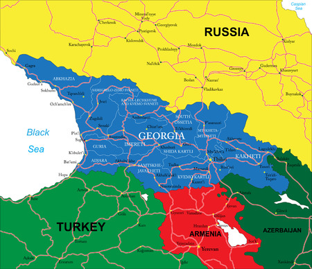
Georgia map
Georgia map123RF Premium
VectorsSimilar Images
Political world map pacific centered vector icon
VectorsSimilar Images
Europe map highlighted france vector illustration blue sea background Stock Photo
Europe map highlighted france vector illustration blue sea background
VectorsSimilar Images
Vector map of the norwegian archipelago lofoten Vector Illustration
Vector map of the norwegian archipelago lofoten123RF Premium
VectorsSimilar Images
Mediterranean basin political map south europe north africa and near east with capitals national borders rivers and lakes english labeling and scaling illustration Stock Photo
Mediterranean basin political map south europe north africa and near east with capitals national borders rivers and lakes english labeling and scaling illustration
VectorsSimilar Images
Peninsula of halkidiki in greece orange map art and blue background
VectorsSimilar Images
South europe region colorful map of countries in southern europe around mediterranean sea vector illustration Vector Illustration
South europe region colorful map of countries in southern europe around mediterranean sea vector illustration123RF Premium
VectorsSimilar Images
Baltic region detailed editable map with cities and towns roads and railways
Baltic region detailed editable map with cities and towns roads and railways123RF Premium
VectorsSimilar Images
Vector contour map of mediterranean sea with caption map of mediterranean sea is isolated on a white background simple flat dotted geographic map template Stock Photo
Vector contour map of mediterranean sea with caption map of mediterranean sea is isolated on a white background simple flat dotted geographic map template
VectorsSimilar Images
World map and navigation icons illustration
VectorsSimilar Images
World map pacific china asia centered view blue color political vector layered
World map pacific china asia centered view blue color political vector layered123RF Premium
VectorsSimilar Images
Gulf of venice political map limited by the po delta in italy and the istrian peninsula in croatia also bordered by slovenia with the gulf of trieste Stock Photo
Gulf of venice political map limited by the po delta in italy and the istrian peninsula in croatia also bordered by slovenia with the gulf of trieste123RF Premium
VectorsSimilar Images
Eastern europe and western asia gray political map with capitals and borders with the black sea caspian sea european russia and with a part of central asia illustration on w
Eastern europe and western asia gray political map with capitals and borders with the black sea caspian sea european russia and with a part of central asia illustration on w123RF Premium
VectorsSimilar Images
Blue world map and flags borders countries and cities vector illustration
VectorsSimilar Images
Baltic sea area colored countries political map with national borders and english names countries along the coast of the baltic sea with surrounding countries in europe
Baltic sea area colored countries political map with national borders and english names countries along the coast of the baltic sea with surrounding countries in europe123RF Premium
VectorsSimilar Images
Blue world map and navigation icons illustration highly detailed world map countries cities water objects
VectorsSimilar Images
Central europe political map with capitals national borders rivers and lakes english labeling and scaling illustration
VectorsSimilar Images
Aegean sea region with aegean islands political map an elongated embayment of the mediterranean sea located between europe and asia and between the balkans and anatolia Stock Photo
Aegean sea region with aegean islands political map an elongated embayment of the mediterranean sea located between europe and asia and between the balkans and anatolia123RF Premium
VectorsSimilar Images
Vector map of nordic countries with big cities and flags
Vector map of nordic countries with big cities and flags123RF Premium
VectorsSimilar Images
Black sea map
Black sea map123RF Premium
VectorsSimilar Images
Shetland islands road map scotland united kingdom
Shetland islands road map scotland united kingdom123RF Premium
VectorsSimilar Images
Political map of europe and the surrounding region Stock Photo
Political map of europe and the surrounding region123RF Premium
VectorsSimilar Images
Baltic nations region detailed editable map with cities and towns roads and railways Stock Photo
Baltic nations region detailed editable map with cities and towns roads and railways123RF Premium
VectorsSimilar Images
Vaccine mosaic and solid map of mediterranean sea vector map of mediterranean sea is designed from vaccine doses and human figures template designed for political posters Stock Photo
Vaccine mosaic and solid map of mediterranean sea vector map of mediterranean sea is designed from vaccine doses and human figures template designed for political posters123RF Premium
VectorsSimilar Images
Political vintage world map vector illustration
VectorsSimilar Images
Blue world map and navigation icons illustration highly detailed world map countries cities water objects
VectorsSimilar Images
Island of patmos in greece orange map art and blue background Stock Photo
Island of patmos in greece orange map art and blue background
VectorsSimilar Images
Scandinavia political map a subregion in northern europe most commonly referring to denmark norway and sweden and more broadly also with aland faroe islands finland and ice Stock Photo
Scandinavia political map a subregion in northern europe most commonly referring to denmark norway and sweden and more broadly also with aland faroe islands finland and ice123RF Premium
VectorsSimilar Images
World map blue and globes asia in center vector
VectorsSimilar Images
Gulf of venice gray political map a bay of water in the northern adriatic sea limited by the po delta and venetian lagoon in italy and the istrian peninsula in croatia
Gulf of venice gray political map a bay of water in the northern adriatic sea limited by the po delta and venetian lagoon in italy and the istrian peninsula in croatia123RF Premium
VectorsSimilar Images
Map of the italian island group aeolian islands in the tyrrhenian sea
Map of the italian island group aeolian islands in the tyrrhenian sea123RF Premium
VectorsSimilar Images
Political physical topographic colored world map vector illustration
VectorsSimilar Images
Highly detailed georgia physical map with labeling
Highly detailed georgia physical map with labeling123RF Premium
VectorsSimilar Images
Map of greece in colored illustration Stock Photo
Map of greece in colored illustration
VectorsSimilar Images
Vector world globe map africa mediterranean sea arabian peninsula centered map blue planet sphere icon isolated on a dark background Stock Photo
Vector world globe map africa mediterranean sea arabian peninsula centered map blue planet sphere icon isolated on a dark background123RF Premium
VectorsSimilar Images
Vector map of the three wadden sea national parks in german language germany Vector Illustration
Vector map of the three wadden sea national parks in german language germany123RF Premium
VectorsSimilar Images
Silhouettes of european country italy and the regions
Silhouettes of european country italy and the regions123RF Premium
VectorsSimilar Images
South europe region map of countries in southern europe around mediterranean sea vector illustration
South europe region map of countries in southern europe around mediterranean sea vector illustration123RF Premium
VectorsSimilar Images
World map yellow blue asia in center vector Stock Photo
World map yellow blue asia in center vector
VectorsSimilar Images
Europe physical map
Europe physical map123RF Premium
VectorsSimilar Images
High detailed croatia physical map with labeling Stock Photo
High detailed croatia physical map with labeling
VectorsSimilar Images
Vector map of nordfriesland district schleswig holstein germany Vector Illustration
Vector map of nordfriesland district schleswig holstein germany123RF Premium
VectorsSimilar Images
World map globes and navigation icons illustration vector illustration of world map and navigation icons Stock Photo
World map globes and navigation icons illustration vector illustration of world map and navigation icons
VectorsSimilar Images
Colored political vector map of european states
Colored political vector map of european states123RF Premium
VectorsSimilar Images
South europe region map of countries in southern europe around mediterranean sea vector illustration
South europe region map of countries in southern europe around mediterranean sea vector illustration123RF Premium
VectorsSimilar Images
High detailed croatia road map with labeling
VectorsSimilar Images
Vintage political world map pacific centered vector
VectorsSimilar Images
Modern illustrated lisbon city map trendy hand drawn stylised map of lisbon with street names and popular locations and things portugal map poster contemporary map design for web and print
Modern illustrated lisbon city map trendy hand drawn stylised map of lisbon with street names and popular locations and things portugal map poster contemporary map design for web and print123RF Premium
VectorsSimilar Images
Vintage political world map pacific centered vector Stock Photo
Vintage political world map pacific centered vector
VectorsSimilar Images
Island of syros in greece orange map art and blue background
VectorsSimilar Images
Black sea and sea of azov region political map with capitals most important cities borders and rivers body of water between eastern europe and western asia illustration english labeling vector
VectorsSimilar Images
Gold dotted mediterranean sea map vector territory maps in shine colors with vertical and horizontal gradients abstract pattern of mediterranean sea map created of rhombic items Stock Photo
Gold dotted mediterranean sea map vector territory maps in shine colors with vertical and horizontal gradients abstract pattern of mediterranean sea map created of rhombic items
VectorsSimilar Images
Blank gray political map of europe and caucasian region simple flat vector illustration
Blank gray political map of europe and caucasian region simple flat vector illustration123RF Premium
VectorsSimilar Images
Political physical topographic colored world map vector illustration
VectorsSimilar Images
World map globes and navigation icons illustration
VectorsSimilar Images
Typography map silhouette of poland in black and flag colors vector illustration Stock Photo
Typography map silhouette of poland in black and flag colors vector illustration
VectorsSimilar Images
Road map of the faroe islands north atlantic archipelago with flag denmark
Road map of the faroe islands north atlantic archipelago with flag denmark123RF Premium
VectorsSimilar Images
Blue world map and navigation icons illustration Stock Photo
Blue world map and navigation icons illustration
VectorsSimilar Images
Ibiza and formentera island spain political map pityusic islands commonly known as pine islands part of the balearic islands an archipelago of spain in the mediterranean sea illustration vector
Ibiza and formentera island spain political map pityusic islands commonly known as pine islands part of the balearic islands an archipelago of spain in the mediterranean sea illustration vector123RF Premium
VectorsSimilar Images
Vector hand drawn stylized map of italian republic travel illustration of italy rivers hand drawn lettering illustration europe mediterranean map element
Vector hand drawn stylized map of italian republic travel illustration of italy rivers hand drawn lettering illustration europe mediterranean map element123RF Premium
VectorsSimilar Images
Vector physical world map Stock Photo
Vector physical world map
VectorsSimilar Images
World map pacific china asia view vintage political topographic vector detailed
World map pacific china asia view vintage political topographic vector detailed123RF Premium
VectorsSimilar Images
Detailed estonia map with infographic elements vector illustration
Detailed estonia map with infographic elements vector illustration123RF Premium
VectorsSimilar Images
Coral sea islands democratic republic of the congo infographics for presentation all countries of the world
VectorsSimilar Images
Districts of istanbul province vector close up detailed map
Districts of istanbul province vector close up detailed map123RF Premium
VectorsSimilar Images
Globe icon set round world map vector flat illustration
VectorsSimilar Images
Island of zakynthos in greece orange map art and blue background
VectorsSimilar Images
Map of caucasian region with states of georgia armenia azerbaijan russia turkey and iran flat blue map with white country borders and labels Vector Illustration
Map of caucasian region with states of georgia armenia azerbaijan russia turkey and iran flat blue map with white country borders and labels123RF Premium
VectorsSimilar Images
South europe region colorful map of countries in southern europe around mediterranean sea vector illustration Vector Illustration
South europe region colorful map of countries in southern europe around mediterranean sea vector illustration123RF Premium
VectorsSimilar Images
Outline skyline panorama of paros island cyclades greece
Outline skyline panorama of paros island cyclades greece123RF Premium
VectorsSimilar Images
Bosnia and herzegovina map
Bosnia and herzegovina map123RF Premium
VectorsSimilar Images
Island of chios in greece orange map art and blue background Stock Photo
Island of chios in greece orange map art and blue background
VectorsSimilar Images
World map blue and icons asia in center vector Stock Photo
World map blue and icons asia in center vector
VectorsSimilar Images
Rhodes greek island political map largest of dodecanese islands of greece in mediterranean sea with several nicknames such as island of the sun the pearl island and the island of the knights
Rhodes greek island political map largest of dodecanese islands of greece in mediterranean sea with several nicknames such as island of the sun the pearl island and the island of the knights123RF Premium
VectorsSimilar Images
Administrative vector map of the french region provence alpes cote d azur with flag
Administrative vector map of the french region provence alpes cote d azur with flag123RF Premium
VectorsSimilar Images
Regions of iceland political map with capital reykjavik eight regions and their seats used for statistical purposes nordic island country in atlantic ocean english labeling illustration vector
Regions of iceland political map with capital reykjavik eight regions and their seats used for statistical purposes nordic island country in atlantic ocean english labeling illustration vector123RF Premium
VectorsSimilar Images
Vintage world map and markers detailed vector illustration Stock Photo
Vintage world map and markers detailed vector illustration
VectorsSimilar Images
Grunge rubber stamp set with text mediterranean tyrrhenian sea
VectorsSimilar Images