filter-iconFilter
close-icon
Media type
License type
Orientation
Exclude

Latin America Map Stock Photos And Images

Brazil
Brazil
Similar Images
Silhouette of latin america map icon over white background vector illustration
VectorsSimilar Images
South america continent map vector illustration on white background
VectorsSimilar Images
South america map vector map of south america with flags vector illustration
VectorsSimilar Images
Planet earth with embossed continents and country borders south america
Similar Images
Map of south america vector illustration outline map of south america hand drawn atlas globe map of south america Stock Photo
Map of south america vector illustration outline map of south america hand drawn atlas globe map of south america
VectorsSimilar Images
The earth rotation view 3 the earth on white background sparse design Stock Photo
The earth rotation view 3 the earth on white background sparse design
Similar Images
North and south america map
VectorsSimilar Images
South america on 3d model of blue earth with embossed countries and blue ocean 3d illustration isolated on white background Stock Photo
South america on 3d model of blue earth with embossed countries and blue ocean 3d illustration isolated on white background
Similar Images
Illustration of south american continent on political globe with atmospheric features and clouds
Similar Images
South america on political globe illustration isolated on white background with shadow
Similar Images
Sun over south america on blue planet earth isolated on black background Stock Photo
Sun over south america on blue planet earth isolated on black background
Similar Images
Map of north and south america vector outline map of south america north america hand drawn globe map of south and north america
VectorsSimilar Images
South america on 3d model of planet earth made of blue marble with embossed countries and blue ocean 3d illustration isolated on white background Stock Photo
South america on 3d model of planet earth made of blue marble with embossed countries and blue ocean 3d illustration isolated on white background
Similar Images
Latin america highlighted on 3d earth model with water and visible country borders 3d illustration
Similar Images
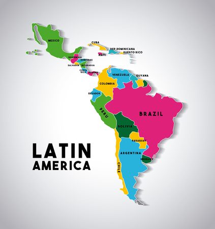
Map of latin america with the countries demarcated in different colors colorful design vector illustration Stock Photo
Map of latin america with the countries demarcated in different colors colorful design vector illustration
VectorsSimilar Images
South america on 3d model of planet earth with grassy continents with embossed countries and blue ocean 3d illustration isolated on white background with shadow Stock Photo
South america on 3d model of planet earth with grassy continents with embossed countries and blue ocean 3d illustration isolated on white background with shadow
Similar Images
Vector highly detailed political map of latin america and their capitals all elements are separated in editable layers clearly labeled eps 10 Stock Photo
Vector highly detailed political map of latin america and their capitals all elements are separated in editable layers clearly labeled eps 10
VectorsSimilar Images
South america
South america
VectorsSimilar Images
Latin america subregions map the subregions caribbean north central and south america in different colors and with national borders of each nation illustration on white background
VectorsSimilar Images
3d world latin america Stock Photo
3d world latin america
Similar Images
Latin america with national flags on political globe 3d illustration Stock Photo
Latin america with national flags on political globe 3d illustration
Similar Images
Map guyana
Map guyana
VectorsSimilar Images
Latin america map icon over blue background vector illustration
VectorsSimilar Images
South america on highly detailed planet earth with embossed continents and country borders
Similar Images
Colorful south america map
VectorsSimilar Images
Point of arrival on old world map brazil flag latin america
Similar Images
South america on planet earth view from space with continents outlines abstract background Stock Photo
South america on planet earth view from space with continents outlines abstract background
VectorsSimilar Images
Purple latin america map silhouette vector illustration isolated on white backgorund
VectorsSimilar Images
Latin america with national flags on 3d globe 3d illustration Stock Photo
Latin america with national flags on 3d globe 3d illustration
Similar Images
Map of argentina Stock Photo
Map of argentina
Similar Images
Brazil and cyprus Stock Photo
Brazil and cyprus
Similar Images
North america with highlighted grenada map illustration
VectorsSimilar Images
Republic of colombia
Similar Images
Political south america map vector illustration isolated on white background editable and clearly labeled layers Stock Photo
Political south america map vector illustration isolated on white background editable and clearly labeled layers
VectorsSimilar Images
Caribbean map
Caribbean map
Similar Images
South america on globe political map
Similar Images
South america on political globe illustration isolated on white background with shadow
Similar Images
South america map
South america map
Similar Images
South america on elegant metallic model of planet earth with blue ocean and shiny embossed continents with visible country borders 3d illustration isolated on white background Stock Photo
South america on elegant metallic model of planet earth with blue ocean and shiny embossed continents with visible country borders 3d illustration isolated on white background
Similar Images
North and south america vector political map in tints of soft blue
VectorsSimilar Images
Americas map vector icon
VectorsSimilar Images
South america map on a brick wall
VectorsSimilar Images
Central america with highlighted mexico map vector illustration Stock Photo
Central america with highlighted mexico map vector illustration
VectorsSimilar Images
South america map background vector
VectorsSimilar Images
South america on 3d model of metallic planet earth made of steel plates with embossed countries 3d illustration isolated on white background
Similar Images
North and south america map black and white
Similar Images
Latin america on simple political globe 3d illustration Stock Photo
Latin america on simple political globe 3d illustration
Similar Images
Latin america on 3d earth with divided countries and watery oceans 3d illustration
Similar Images
Latin america with embedded national flags on blue political globe 3d illustration Stock Photo
Latin america with embedded national flags on blue political globe 3d illustration
Similar Images
Red grunge continent america
VectorsSimilar Images
Set of flags of latin america icon Stock Photo
Set of flags of latin america icon
VectorsSimilar Images
Outline map of south america with ecuador raised and highlighted with the national flag
Similar Images
Brazil map and flag in circle map of brazil brazil flag pin map of brazil in the style of the globe vector illustration Stock Photo
Brazil map and flag in circle map of brazil brazil flag pin map of brazil in the style of the globe vector illustration
VectorsSimilar Images
North and south america map Stock Photo
North and south america map
VectorsSimilar Images
Highly detailed planet earth with embossed continents and visible country borders featuring south america isolated on white background
Similar Images
Brazil and france
Brazil and france
Similar Images
Latin america from space on earth with country borders and lines concept of communication travel connections 3d illustration
Similar Images
Latin america from space on earth with lines representing international connections communication travel 3d illustration Stock Photo
Latin america from space on earth with lines representing international connections communication travel 3d illustration
Similar Images
Outline map of south america with argentina raised and highlighted with the national flag Stock Photo
Outline map of south america with argentina raised and highlighted with the national flag
Similar Images
World map render 3d with darts concept of world market Stock Photo
World map render 3d with darts concept of world market
Similar Images
Hand drawn doodle brazil map icon vector illustration isolated on white background brazilia outer borders symbol cartoon ribbon band element icon brasilia symbol
VectorsSimilar Images
South america
South america
VectorsSimilar Images
Latin america on 3d model of earth with water and divided countries 3d illustration Stock Photo
Latin america on 3d model of earth with water and divided countries 3d illustration
Similar Images
Latin america on earth with trajectories representing international communication travel connections 3d illustration
Similar Images
South america on 3d model of metallic planet earth made of steel plates with embossed countries 3d illustration isolated on white background
Similar Images
South america on globe political map Stock Photo
South america on globe political map
Similar Images
Map of america vector illustration scribble sketch america Stock Photo
Map of america vector illustration scribble sketch america
VectorsSimilar Images
Map of south america vector illustration
VectorsSimilar Images
Collage of de janeiro brazil images travel background my photos
EditorialSimilar Images
Political south america map vector illustration isolated on white background editable and clearly labeled layers
VectorsSimilar Images
Latin america from space with visible country borders and global connections representing communication or air travel 3d illustration Stock Photo
Latin america from space with visible country borders and global connections representing communication or air travel 3d illustration
Similar Images
Zoom on ecuador map and flag world map
VectorsSimilar Images
3d map of america cube design Stock Photo
3d map of america cube design
Similar Images
Sketch america letter text continent america word in the shape of the continent map of continent america red and blue vector illustration
VectorsSimilar Images
Old maps
Old maps
Similar Images
Illustration in the style of a flat design with the main sights of some latin america countries
VectorsSimilar Images
Business man showing earth map south america
VectorsSimilar Images
Latin america on model of earth with country borders and blue oceans with waves 3d illustration
Similar Images
Political map of south america on globe Stock Photo
Political map of south america on globe
Similar Images
Colorful south america vector Stock Photo
Colorful south america vector
VectorsSimilar Images
South america on political globe on black background
Similar Images
Political map of south america on globe Stock Photo
Political map of south america on globe
Similar Images
Latin america from space on planet earth with country borders and international connections representing travel communication 3d illustration
Similar Images
South america on bright metallic model of planet earth with blue ocean and shiny embossed continents with visible country borders 3d illustration isolated on white background
Similar Images
Costa rica political map Stock Photo
Costa rica political map
VectorsSimilar Images
Concept of planet earth as seen from space but with political borders aimed at south american continent Stock Photo
Concept of planet earth as seen from space but with political borders aimed at south american continent
Similar Images
Latin america from space on earth at night very fine detail of the plastic planet surface with bright city lights 3d illustration
Similar Images
Drawing map of latin america and brazil
VectorsSimilar Images
Brazil and argentina
Similar Images
Network over south america information technology concept elements of this image furnished by nasa Stock Photo
Network over south america information technology concept elements of this image furnished by nasa
Similar Images
Political map of south america on globe
Similar Images
South america contoured map with highlighted bolivia bolivia map and flag on south america map vector illustration
VectorsSimilar Images
Galapagos islands on the map of south america in soft grunge and vintage style like old paper with watercolor painting Stock Photo
Galapagos islands on the map of south america in soft grunge and vintage style like old paper with watercolor painting
Similar Images
South america on translucent model of planet earth with visible continents blue shaded countries 3d illustration isolated on white background
Similar Images
Political south america map vector illustration isolated on white background with country names in spanish editable and clearly labeled layers Stock Photo
Political south america map vector illustration isolated on white background with country names in spanish editable and clearly labeled layers
VectorsSimilar Images
Flags of latin america countries on buttons colorful design vector illustration
VectorsSimilar Images
Green latin america highway sign on cloud background
Similar Images
Global network map
Global network map
Similar Images