Home
PLUS
AI Generator Tools
New
AI Image Generator
Delivering creativity at your imagination.
New
AI Image Upscaler
Scale your images up to 4x a click!
New
AI Generative Fill
Remove and replace objects in seconds!
New
AI Background Blur
Blur backgrounds to make subjects stand out!
AI Background Remix
Professional backgrounds for your products.
AI Image Extender
Extend your images to different ratios.
AI Writer
Best writing companion for the digital age.
AI Background Remover
Remove unwanted backgrounds easily.
123RF PLUS
Get creative solutions powered by cutting-edge AI tools.
Go PLUS
We have 2 new AI tools!
Check out AI Image Upscaler and AI Generative Fill now!
OK
Free Images
Stock
Photos
Vectors
Video
Audio
Fonts
Corporate+
Pricing
Support
en
English
Deutsch
Español
Français
Magyar
Italiano
日本語
한국어
Nederland
Język polski
Português (PT)
Русский язык
简体中文
繁體中文
Türkçe
Login
Go unlimited
Search by image
Search 123RF with an image instead of text. Try dragging an image to the search box.
Drag and drop file or
Browse
Drag image here
All Images
Options
Search by image
PREMIUM
All Images
Photos
Vectors
Video
Audio
Fonts
FREE
PLUS
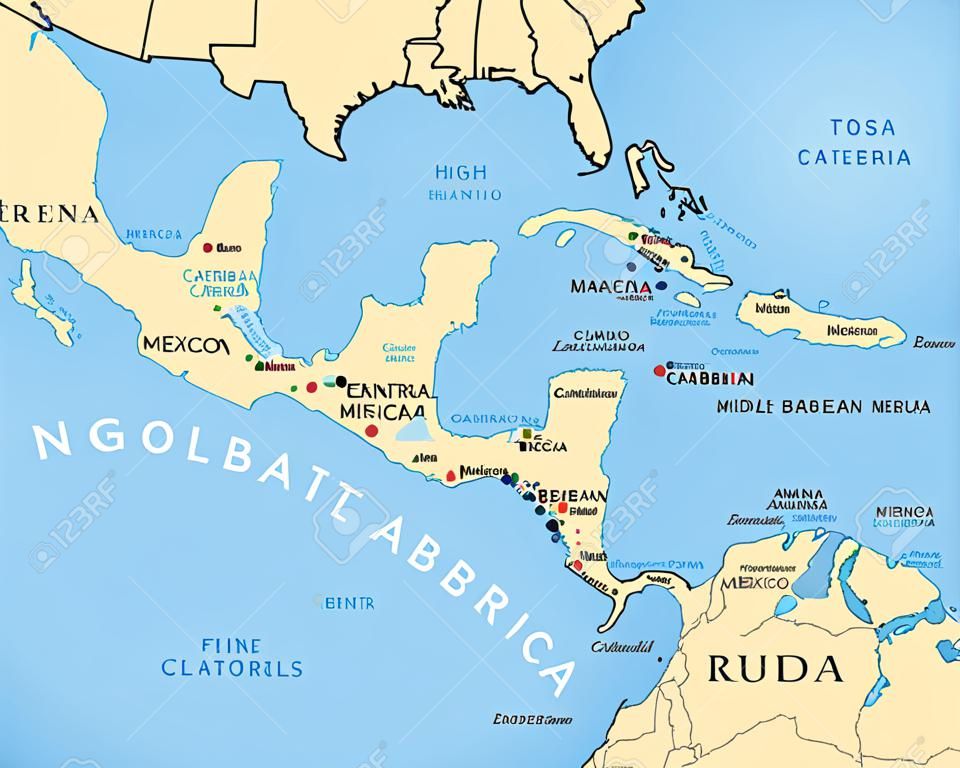
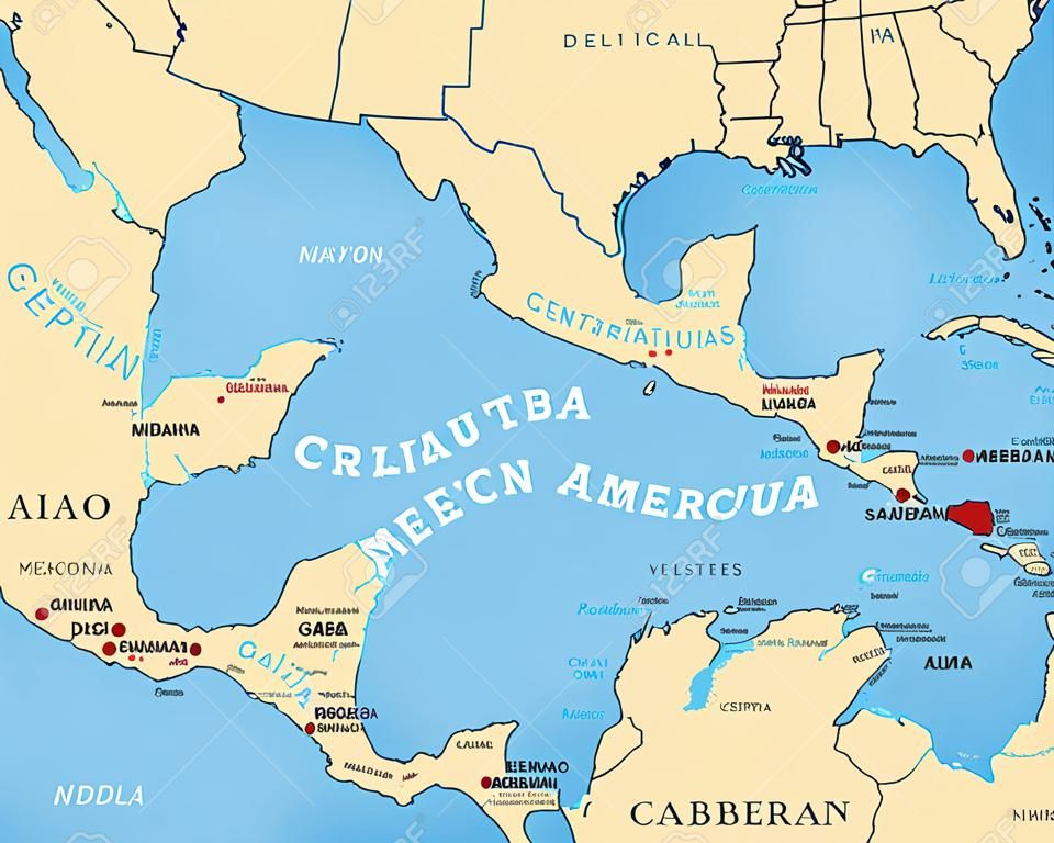
Middle America political map with capitals and borders. Mid-latitudes of the Americas region. Mexico, Central America, the Caribbean and northern South America. Illustration. English labeling. Vector.
AI Variation
AI Variation
peterhermesfurian
Follow
Preview
Share
X
Facebook
Pinterest
81005810
PLUS Stock Vector
(SVG or EPS)
Related Stock Photo Searches
gulf mexico
caribbean map
central america
central america map
venezuela map
galapagos islands
americas
central america caribbean map
map caribbean
pacific
political map
ocean
destination
caribbean
galapagos
middle
travel
capital
labeling
sea
central
antilles
cruise
region
venezuela
illustration
gulf
south
atlantic
island
south america
middle america
country
colombia
brazil
atlas
map
mexico
geography
cuba
ecuador
english
america
border
cartography
Similar stock images (Vector, SVG, and EPS)


 Pinterest
 81005810

 New
New
 New
New
 New
New


